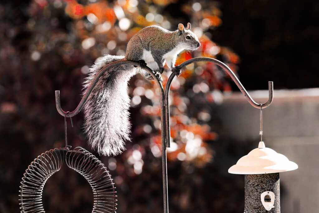
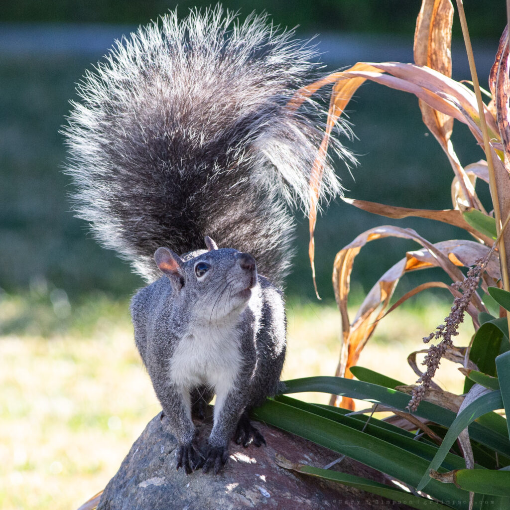
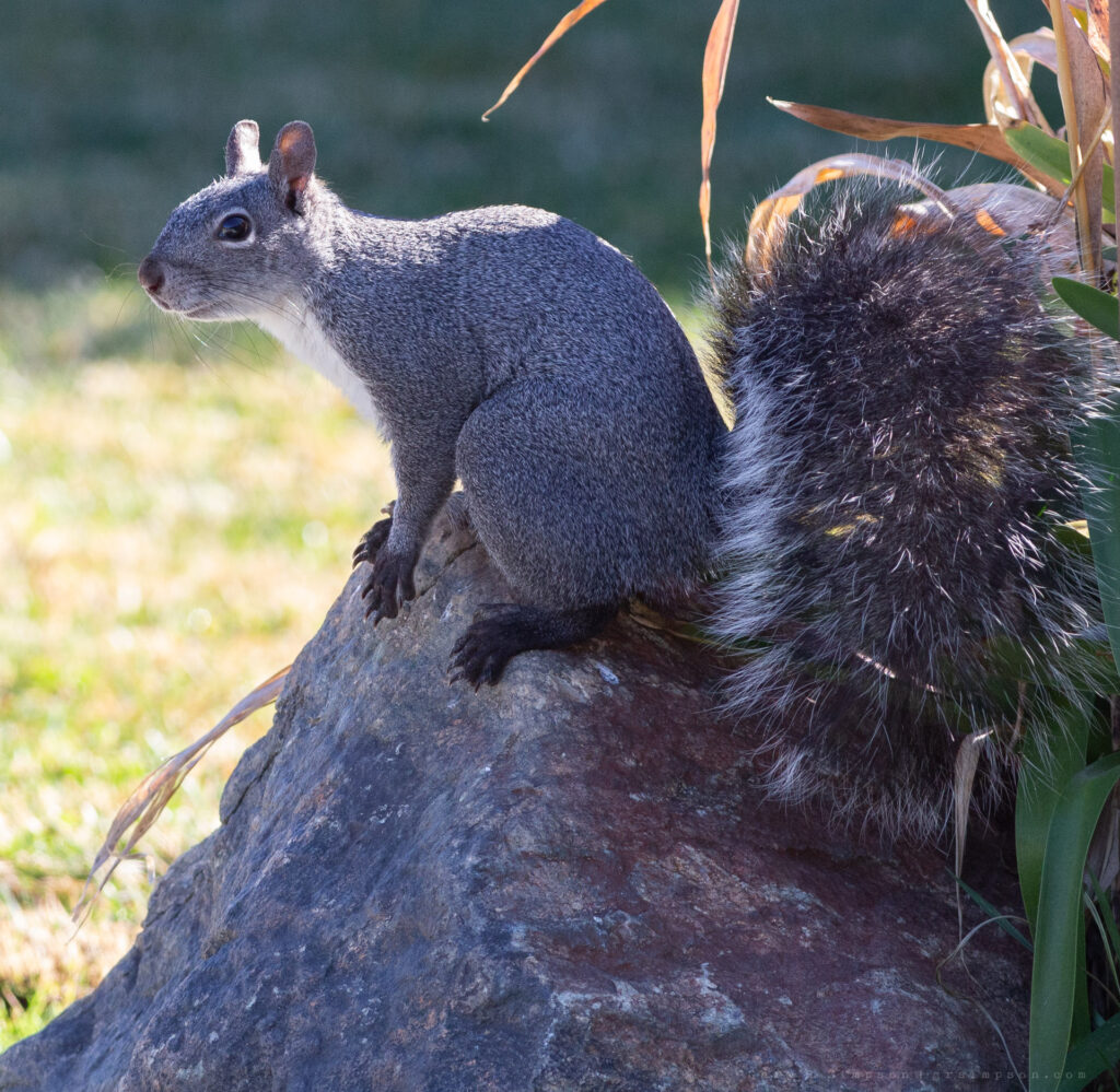
Southern California is the only place where your backyard can feel like a luxury resort you accidentally built for western gray squirrels instead of yourself. You step outside with a cup of coffee, only to discover a furry neighborhood committee holding what appears to be an emergency meeting in the oak tree, pausing just long enough to judge your landscaping choices before sprinting across the fence like tiny Olympic parkour champions. Every acorn is treated like a priceless family heirloom, every bird feeder is an all-you-can-eat buffet they insist they don’t technically own, and somehow they always freeze in place the instant you catch them in the act, as if you’re the one interrupting their peaceful morning. By the end of the day, you’ve accepted the truth: you don’t actually have a backyard—you just pay the property taxes for the squirrels’ wildly successful outdoor adventure park.
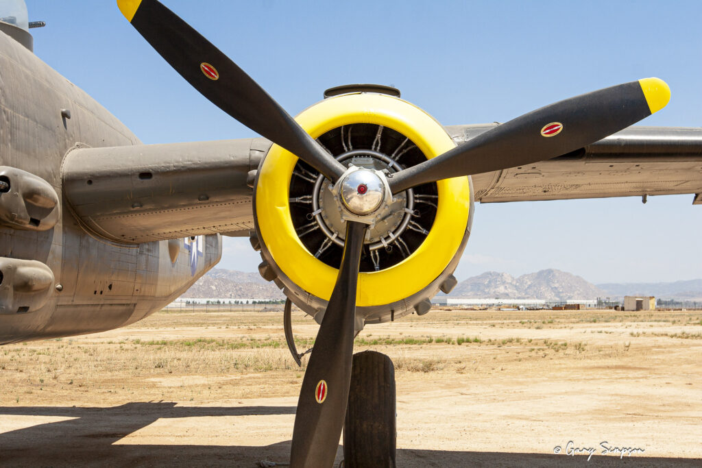
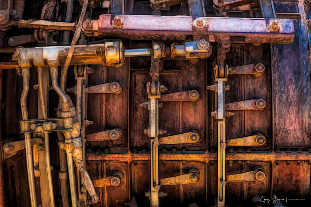
This specific aircraft did not see combat in World War II because it was delivered to the military on March 29, 1945, just months before the war ended. Because the conflict was winding down, the Army Air Forces placed this brand-new bomber directly into stateside storage in Texas, and it spent the post-war years operating as a pilot trainer before being retired and later used in the 1970 Hollywood film Catch-22.
However, the distinct paint scheme on this aircraft tells a very different story. The March Field Air Museum painted and restored the plane to honor the 42nd Bomb Group of the 13th Air Force, which saw heavy action in the Pacific Theater. In real life, the airmen of that group used heavily armed B-25 strafers to carry out dangerous, low-level bombing runs against Japanese shipping lanes, airfields, and military installations across the Southwest Pacific, including major campaigns in New Guinea, the Solomon Islands, and the Philippines.
I enjoy using my photography to create digital art. The photography community’s feelings toward digitally enhanced art seem to be deeply split. It’s a spectrum that ranges from embracing powerful new workflows to feeling a profound sense of “AI exhaustion” and concern about the erasure of the craft.
Most photographers agree that the dividing line comes down to intent and transparency. If a creator is open about their work being a “digital composite” or “AI-assisted,” the community generally respects it as a valid form of digital art. The anger primarily ignites when a heavily manipulated image is passed off as a raw, authentic photograph.
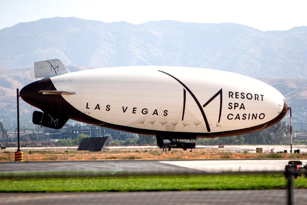
In late 2008, the M Resort Spa Casino deployed its branded airship to Southern California as part of a strategic marketing campaign to generate awareness for the property ahead of its scheduled March 2009 opening. The blimp was tasked with touring various communities throughout the Inland Empire, including San Bernardino, to promote the $1 billion luxury hotel and casino. The distinctive airship made a notable stop at what was formerly Norton Air Force Base, now known as San Bernardino International Airport.
The journey to Southern California was not without its challenges, as high winds forced the airship to endure a three-day layover in Barstow before it could complete the trip. Once it arrived, the blimp was stationed at the San Bernardino facility for several weeks to serve as a high-visibility promotional tool. By hovering over the region, the M Resort aimed to establish a strong brand presence in the local market, effectively utilizing the massive airship to capture the attention of prospective visitors living outside of the Las Vegas Valley.
The “M Lightship,” as it was known, is no longer in operation. The airship was a promotional tool used exclusively during the lead-up to the resort’s opening in 2009. It was a 178-foot electronic blimp equipped with a massive LED screen that circled the Las Vegas Valley and flew over various cities in the Southwest to generate buzz for the new property. Once the resort opened in March 2009, the blimp finished its promotional run and was retired. It is no longer part of the M Resort’s marketing or amenities.
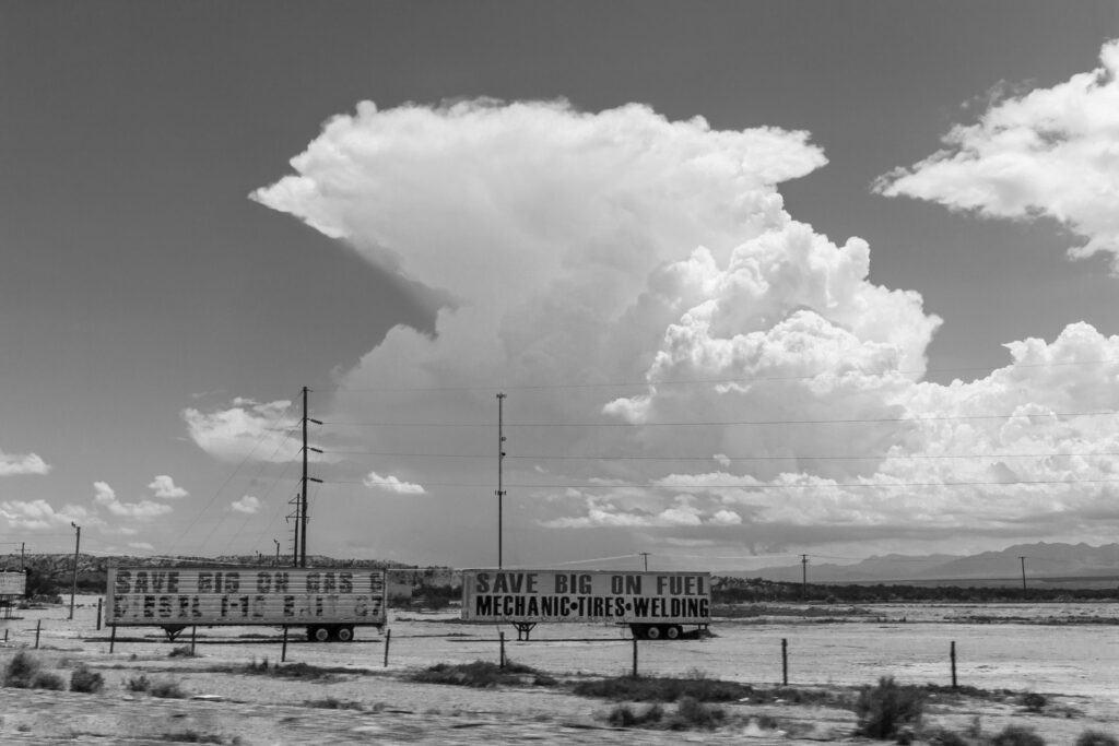
Cumulonimbus clouds rise like towering, sunlit mountains in the sky, built from powerful updrafts that lift warm, moist air high into the atmosphere until it cools and condenses into dense, dramatic columns capable of producing thunderstorms, heavy rain, hail, and even tornadoes. Their anvil-shaped tops spread outward when they reach the upper limits of the troposphere, signaling intense atmospheric energy and rapid vertical motion that make them some of the most dynamic and awe‑inspiring features of weather, often prompting meteorologists to monitor them closely through tools such as severe storm tracking.
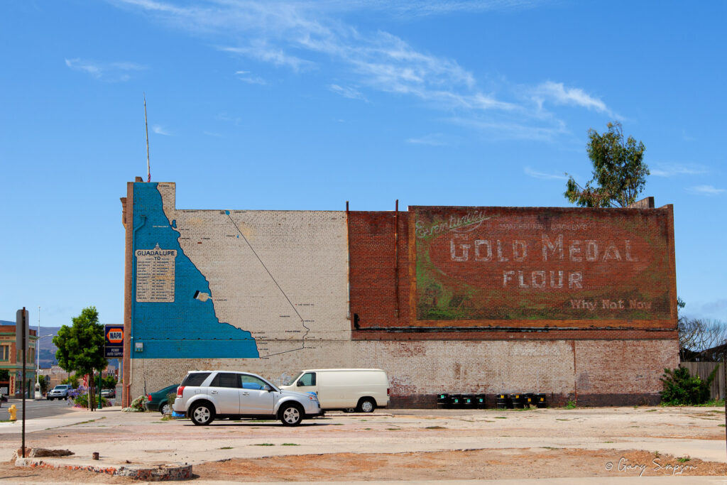
The weathered advertisement painted on the brick facade shown here is a classic example of an early 20th-century “ghost sign” featuring one of American marketing’s most enduring campaigns. The iconic slogan, “Eventually—Gold Medal Flour—Why Not Now?” was first introduced in 1907 by the Washburn-Crosby Company, which later evolved into General Mills. During the 1910s and 1920s, the company employed traveling commercial artists known as “wall dogs” to hand-paint these massive, bold advertisements directly onto the brick walls of prominent local grocery stores, bakeries, and supply warehouses across the United States. In agricultural hubs like Guadalupe, these vibrant signs served as major landmarks on main thoroughfares, though decades of sun exposure and weathering have since faded the paint into a rustic, nostalgic artifact that offers a glimpse into early American consumer culture and the historical footprint of national corporate advertising in small-town communities.
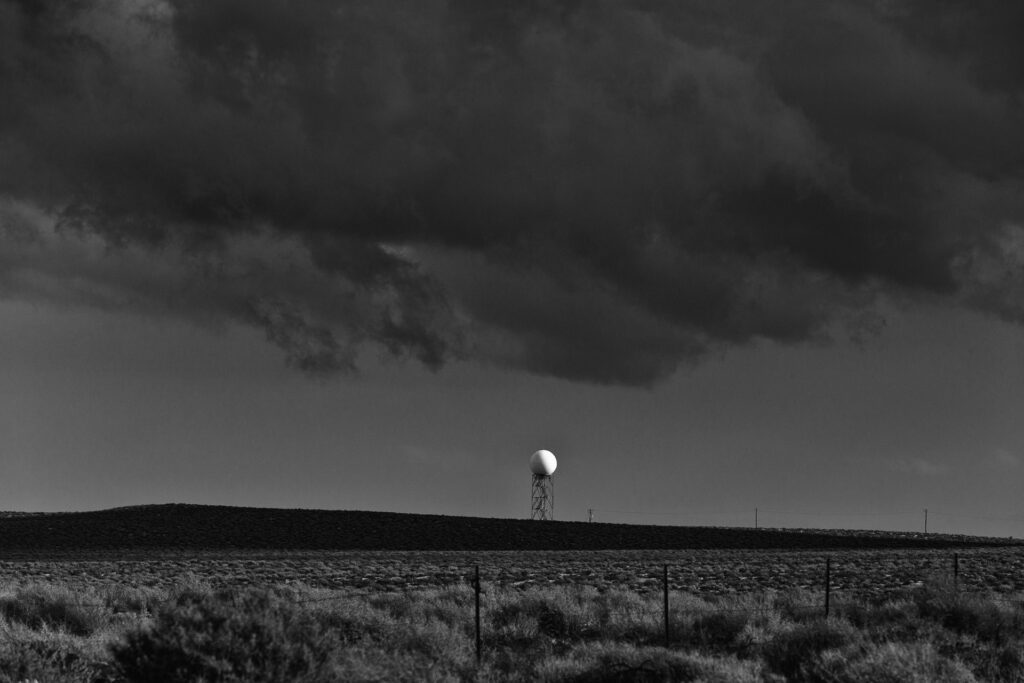
Mojave Desert, near the unincorporated community of Kramer Junction, California
This radar dome (radome), of the KEYX radar station based at California’s Edwards AFB, is part of a nationwide network of 160 high-resolution S-band Doppler weather radars operated by the U.S. National Weather Service. A radome is an electronic antenna enclosure and is typically used to enclose radar systems and satellite communications antennas. The composite radome shown here is a sandwich radome — a rigid, self-supporting shell type structure constructed of doubly-curved panels which form a spherical dome.
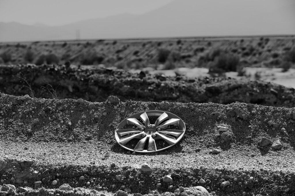
Dirt roads have a mysterious appetite for wheel covers, quietly collecting them like trophies while unsuspecting drivers bounce along, blissfully unaware that one of their hubcaps has just achieved total independence. One particularly enthusiastic pothole, a strategically placed rock, or a washboard section is all it takes for a wheel cover to launch into the sagebrush with the confidence of a NASA mission. It’s one of off-roading’s oldest traditions: the dirt road always gets a souvenir, and it’s usually made of plastic.
AI tells me that this is a 16-inch factory wheel cover from a 2017-2019 Hyundai Elantra, probably with SE trim. What do you think?
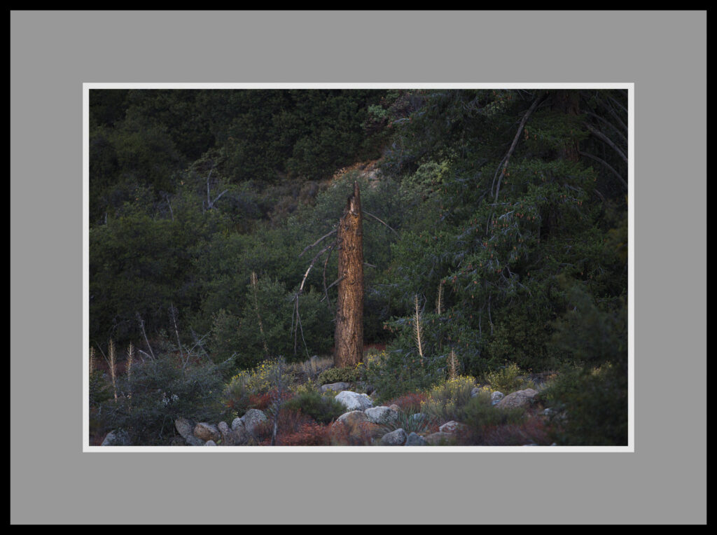
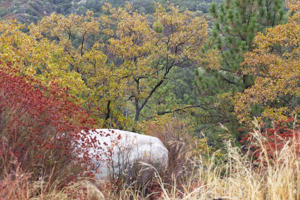
In the fall, the flora of the San Bernardino Mountains displays a striking mix of colors and textures as native deciduous trees, including black oaks, bigleaf maples, and California sycamores, turn shades of gold, orange, and russet before shedding their leaves. These vibrant hardwoods contrast with the year-round green of Jeffrey pines, ponderosa pines, incense cedars, and white firs that dominate higher elevations. Lower slopes are filled with chaparral species such as manzanita, mountain mahogany, and California lilac, many of which develop reddish tones that add warmth to the landscape. Native grasses dry to a golden hue, while shrubs and understory plants prepare for winter dormancy, creating a mosaic of evergreen and seasonal vegetation that reflects the region’s diverse elevations, Mediterranean climate, and rich ecological variety.
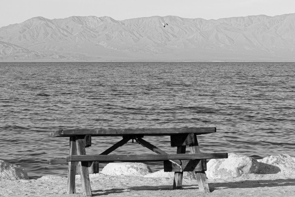
Welcome to the Salton Sea, California’s premier accidental oasis, where the vibes are vintage, the water is a gorgeous shade of “don’t touch that,” and the local aroma tends to be a delicate blend of salt, agricultural runoff, and broken resort-town dreams. Born out of a classic engineering oopsie in 1905 when the Colorado River decided to take an unscheduled detour, this massive desert lake spent the 1950s masquerading as a glamorous Riviera for Hollywood elite before realizing its true calling as a dystopian, post-apocalyptic film set.
Today, the scenic picnic bench offers the perfect front-row seat to admire mountains that look stunningly majestic, provided you hold your breath long enough to ignore the crunchy shore made entirely of pulverized fish skeletons. It is truly the only place on Earth where you can simultaneously get a beautiful sun tan, experience an ecological crisis, and wonder if that lone seagull flying overhead is actually just trying to find a highway back to civilization.
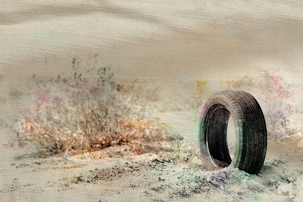
For anyone who grew up around older cars, the phrase “nylon belted tires” brings back memories of an era when every morning drive began with a few miles of thump-thump-thump. Introduced widely during the 1960s and 1970s, nylon belted automobile tires used layers of strong nylon cords beneath the tread to improve durability over earlier bias-ply designs. They represented an important step forward, offering better tread life and handling than traditional bias-ply tires while remaining less expensive than the steel-belted radial tires that would eventually dominate the market. Their biggest quirk was the tendency to develop temporary flat spots after sitting overnight, especially in cool weather, causing vibrations until the tires warmed up and regained their shape. By the 1980s, steel-belted radial tires had largely replaced nylon belted designs because they provided superior traction, fuel economy, ride comfort, and tread wear, leaving nylon belted tires as an interesting milestone in the evolution of automotive technology and a nostalgic reminder of a very different driving experience.
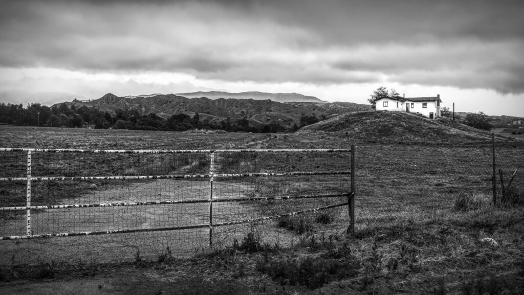
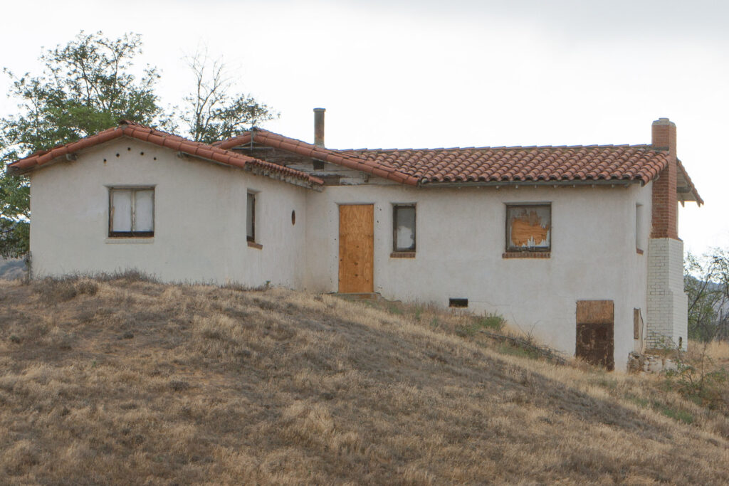
The house shown here is a well-known abandoned local landmark located alongside I-10 on a prominent knoll in the open fields of Calimesa, California. The property has been abandoned for several decades. Over the years, it has become a popular subject for local landscape photographers due to its stark, isolated placement on the hilltop against the backdrop of the rugged foothills. Because of its high-visibility location just off the paths of expanding local developments, it remains a nostalgic feature for commuters and residents traveling between Yucaipa, Calimesa, and Beaumont.
Stuffed chairs in motel rooms are the unsung heroes of travel, bravely accepting everything from your jacket and backpack to that mysterious shopping bag you swear you’ll unpack later. They’re the perfect place to sit while tying your shoes, pretending to read the local tourism brochure, or dramatically staring out the window as if you’re in the final scene of an award-winning movie instead of overlooking the parking lot. At some point they become your unofficial luggage valet, snack station, and laundry sorting department, all without filing a single complaint. If the bed is the star of the motel room, the stuffed chair is the hardworking supporting actor who quietly keeps the whole production from descending into complete vacation chaos.
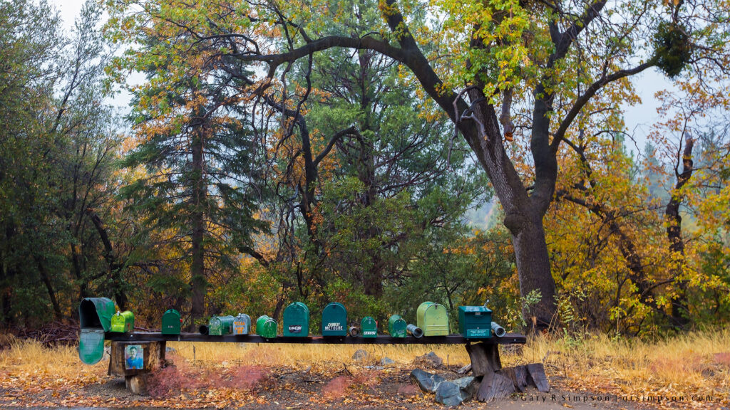
In the early days of rural mail delivery in the San Bernardino Mountains, getting the mail was less of a routine and more of an adventure with a schedule that politely ignored the clock. Mail carriers bounced along rocky wagon roads, crossed creeks that sometimes decided to become rivers overnight, and climbed steep grades where even the horses looked like they wanted a day off. Residents learned that if the mail arrived on Tuesday instead of Monday, it simply meant a fallen tree, a washed-out road, or a particularly stubborn mule had exercised its right to negotiate. Yet somehow the letters, newspapers, seed catalogs, and long-awaited packages almost always made it through, proving that mountain mail carriers possessed an uncanny combination of grit, optimism, and the remarkable ability to smile while delivering your overdue bill.
Vibrant Warmth, Intricate Texture, Abundance and Layering
I like the hyper-detailed and intensely saturated aesthetic of this image. It was processed using a combination of High Dynamic Range (HDR) tone mapping and aggressive micro-contrast enhancement. The photograph was captured using a high-resolution digital camera under bright, diffused lighting to minimize harsh shadows while preserving the intricate textures of the petals and foliage. In post-processing, local contrast adjustments—such as “Clarity” or “Texture” sliders in digital editing software—were pushed significantly to accentuate the edge definitions and surface details of the plants, giving them a sharp, almost illustrated appearance. Additionally, the color saturation and vibrance were amplified selectively across the warm spectrum, causing the corals and yellows to pop intensely, while a slight unsharp mask or sharpening filter was applied globally to finalize the crisp, high-definition texture across the entire tightly cropped frame.
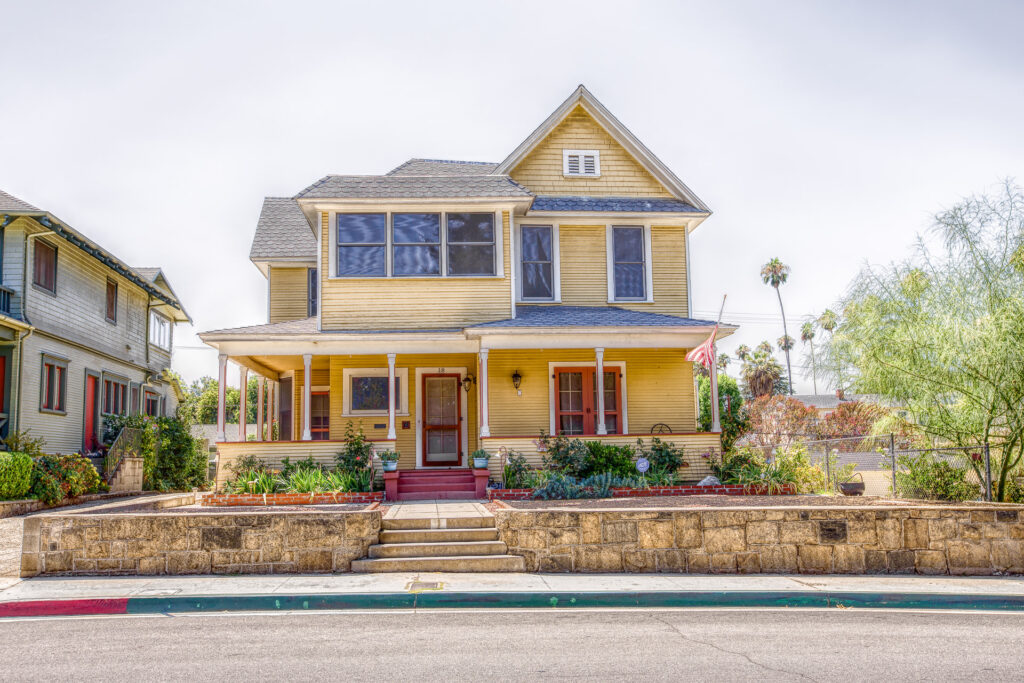
This home is a classic example of American Queen Anne Victorian architecture, a popular style from the late 1800s that emphasizes visual interest through asymmetrical massing, steeply pitched gables, varied rooflines, and an expansive wraparound porch. Rather than relying on elaborate ornamentation alone, the design creates character with projecting bays, decorative wood shingle siding in the upper gables, tall narrow double-hung windows, and a mix of horizontal clapboard and textured surfaces that add depth and contrast. The broad front porch, supported by slender columns, softens the home’s imposing height while providing an inviting transition from the street, making it a fine example of the elegant yet livable Victorian homes that once defined many historic American neighborhoods.
Carlsbad State Beach Campground, Carlsbad, California
Few moments in life offer a more jarring reality check than realizing you are stranded on a beach campground toilet with absolutely nothing but a cardboard tube and your own deep regrets. In the wild frontier of coastal camping, where the diet consists mostly of questionable canned chili and sketchy cooler meat, a fully stocked toilet paper dispenser is the ultimate luxury, outranking even a stable Wi-Fi connection. Without an abundant supply of the white gold, you are forced into a state of immediate, high-stakes panic, frantically scanning the stall for a discarded napkin, a forgotten receipt, or God forbid, a smooth-looking leaf from a nearby dune. Having enough toilet paper means avoiding that desperate, undignified waddle of shame back to your tent, or worse, having to use a stray sock that you will never be able to look at the same way again.
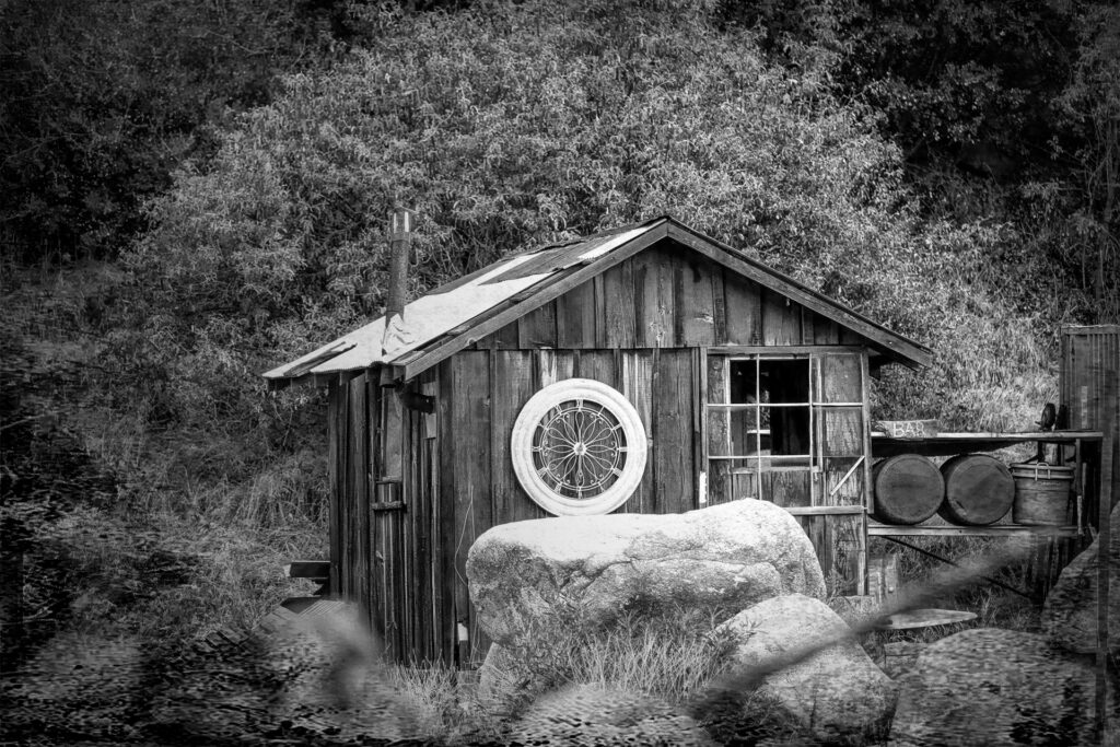
Nestled deep in the rugged hills, this rustic little shack proudly masquerades as an artisanal mountain distillery where the local moonshine is brewed with an uncompromising dedication to flavor, questionable hygiene standards, and a chimney that mostly just channels pure charcoal-scented chaos into the wilderness. Guarded by massive boulders and an ornamental wagon wheel that clearly doubles as a high-tech security radar, the establishment offers a bespoke open-air bar setup where barrels of fiery liquid patience sit waiting for brave souls whose livers are stronger than their common sense.
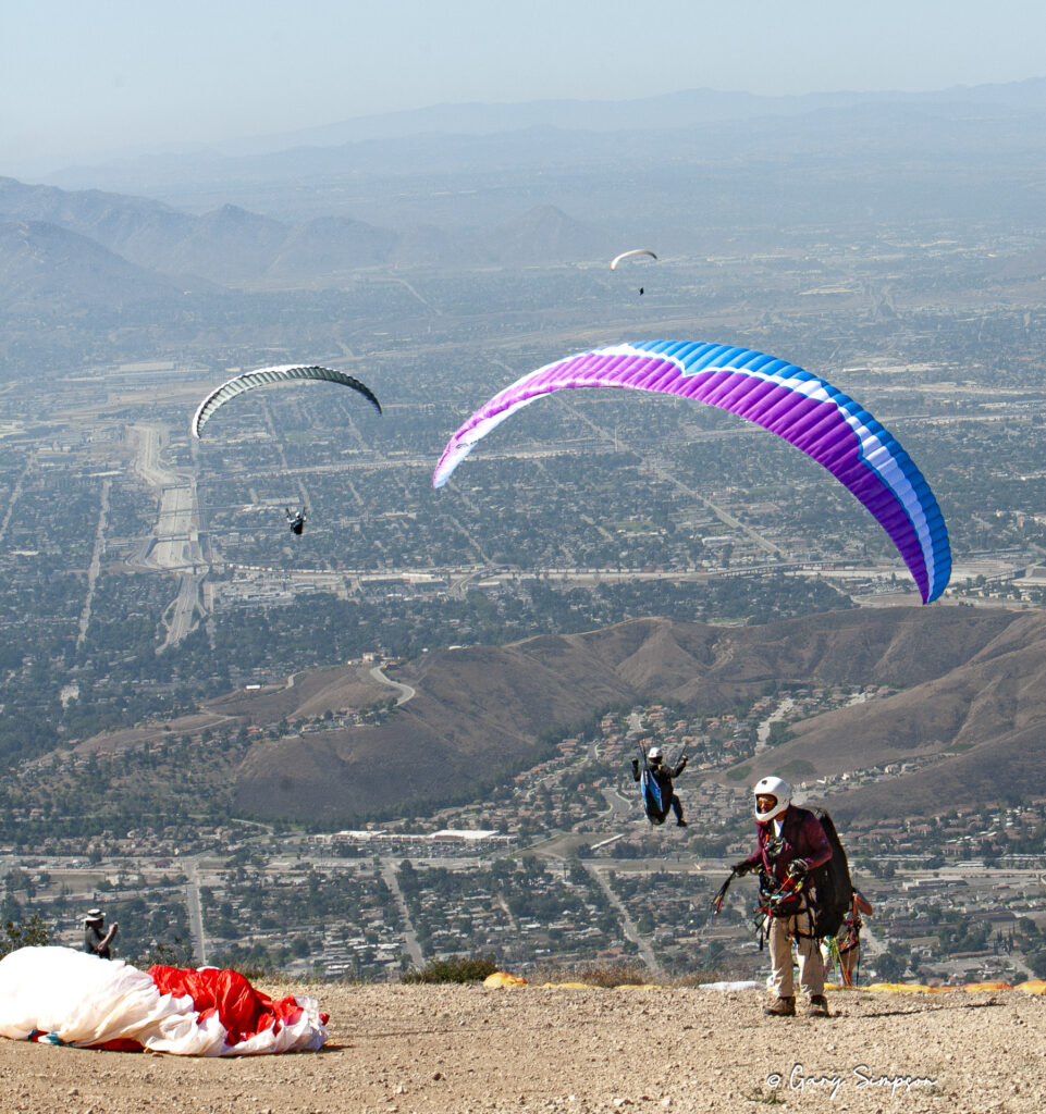
The San Bernardino Mountains—specifically the Crestline and Marshall Peak areas—are home to one of the most famous, world-class hang gliding and paragliding zones in the United States. Because of the unique wind patterns coming off the Pacific Ocean mixing with the mountain air, it creates massive, reliable thermals that allow pilots to soar for hours.
This photo was taken at Marshall Peak (Elevation ~4,000 ft) which is the primary and most popular launch site for paragliders. It has a forgiving, gentle slope that accommodates multiple wings launching at once, and, weather permitting, it works beautifully year-round.
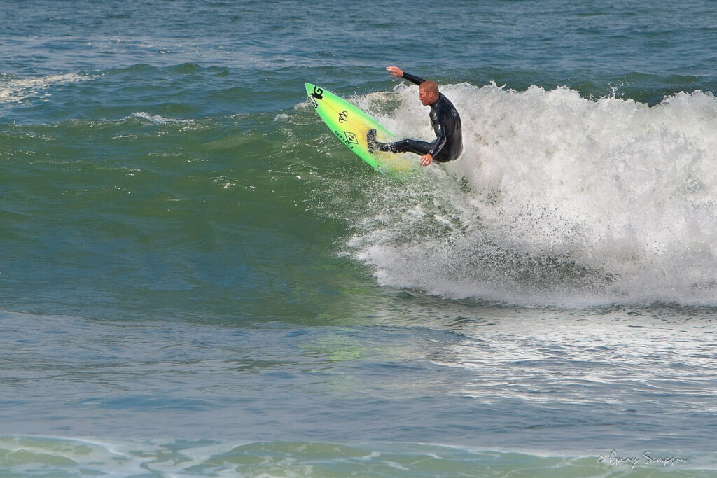
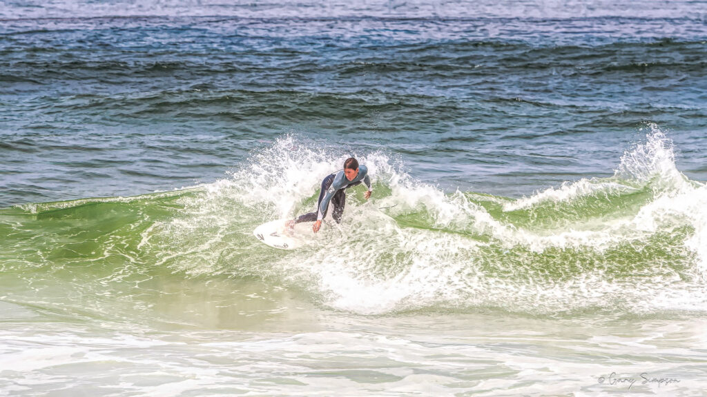
Surfing at Guadalupe-Nipomo Dunes on California’s Central Coast is a rugged, isolated experience reserved for adventurous and experienced wave riders. Because this sprawling coastal reserve is highly exposed to the open Pacific, the surf is characterized by heavy, shifting beach breaks, powerful currents, and unpredictable sandbars that constantly reshape the lineup. The waters here are notoriously chilly and frequently wind-whipped, demanding a wetsuit and sharp situational awareness, especially given the area’s remote nature and lack of immediate lifeguards. If you’re willing to brave the demanding paddle outs and wild elements, the dunes offer a raw, uncrowded connection to the ocean with a dramatic backdrop of towering coastal sands.
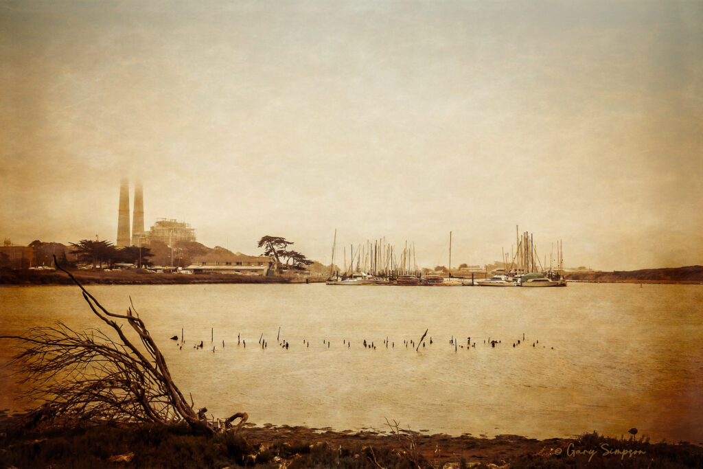
Moss Landing, an unincorporated community in Monterey County, California
Moss Landing’s role in 1970s marijuana smuggling along the Monterey County coast grew out of its secluded coastal geography, working-harbor culture, and proximity to both Mexican supply routes and overland distribution networks, fostering an adaptable shadow economy that blended local knowledge with long-range smuggling techniques.
Small commercial fishing boats, pleasure craft, and converted trawlers were routinely used as low-profile motherships to rendezvous with larger vessels or pickup points several miles offshore, where contraband would be transferred at night to smaller, faster skiffs that could slip into quiet coves and back channels; captains and crews who knew the tidal schedules, sandbars, and lesser-used landings were prized because they could navigate shallow approaches that deterred law enforcement. Once ashore, loads were concealed in fish holds, bait tanks, or false compartments and sometimes temporarily stashed in locked seafood warehouses, private garages, or rural properties; from there the cargo moved by truck or private car along back roads to processing sites and distribution hubs in inland cities. Smuggling operations relied on a mix of longstanding maritime tradesmen—fishermen, boat mechanics, and dockworkers—and opportunistic outsiders who furnished cash, contacts, or logistics, while some local businesses unwittingly provided cover by masking increased nighttime activity and vehicle traffic. Communication used coded radio calls, prearranged light or flag signals, and meet points that took advantage of the region’s fog banks and long stretches of unpatrolled shoreline; organizers also exploited jurisdictional gaps between county, state, and federal agencies, timing transfers when enforcement resources were thin or attention was focused elsewhere.
Law enforcement responses evolved from local sheriff’s patrols and Coast Guard checks to multiagency investigations and sting operations as authorities traced distribution networks and pursued prosecutions, with raids, seizures, and arrests intermittently disrupting activities but never fully ending them due to high profits, resilient smuggling knowledge, and changing demand. The Moss Landing period of smuggling left a complex legacy: it highlighted vulnerabilities in coastal policing and supply-chain interdiction, influenced later surveillance and enforcement strategies, and became part of regional lore—stories of nighttime rendezvous, hidden caches, and narrow escapes that mingled practical seamanship with criminal improvisation during an era of shifting drug markets and law-enforcement priorities.
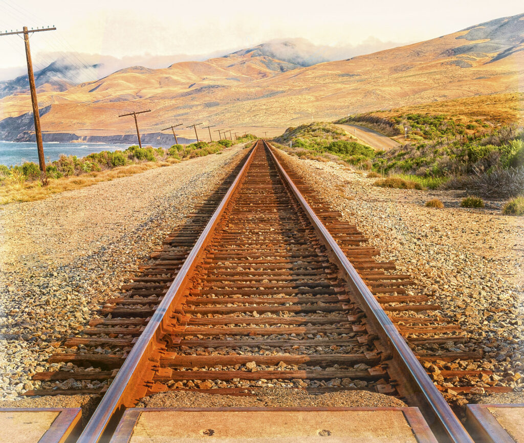
Near Jalama Beach County Park in Santa Barbara County, California
This stretch of Union Pacific railroad tracks is part of the historic Surf Line (originally built by Southern Pacific), which bridges the gap between Los Angeles and San Francisco. Because it cuts right through Vandenberg Space Force Base and massive private ranches, the beach at Jalama is one of the only public vantage points where you can watch trains navigate this dramatic coastal edge.
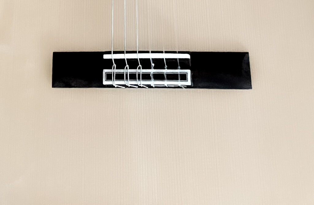
I bought a Cordoba Fusion 5 nylon string AE guitar in late December of 2024. Since then it’s become one of my favorite guitars. It’s easy to hold, easy to play, and sounds pretty good for it’s price point.
Nylon string guitars are basically the golden retrievers of the guitar world—soft, forgiving, and eager to be your friend, whereas steel strings are more like a cat that’s decided your fingertips personally wronged it in a past life. Press down on nylon and it gently yields like a memory foam mattress; press down on steel and it responds with the enthusiasm of a cheese grater meeting your fingerprints, leaving beginners with tiny trenches carved into their fingertips that look suspiciously like they’ve taken up a career in barbed wire installation. The wider neck on a nylon guitar sounds intimidating until you realize it’s just giving your fingers more room to be clumsy without accidentally muting three strings at once, unlike steel string necks, which seem engineered by someone who hated human hands. So while steel strings reward you with that bright, chest-thumping projection, nylon strings reward you with the simple luxury of still wanting to play guitar tomorrow instead of nursing your fingertips like they survived a minor kitchen accident.
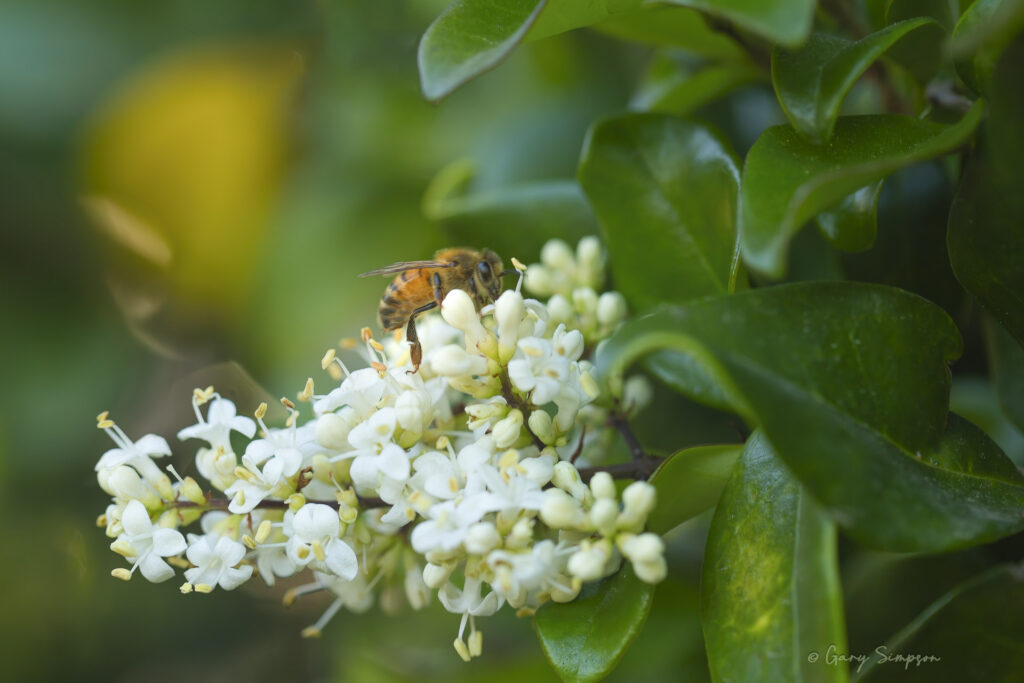
The exquisite synergy between a honeybee and a blossom is one of nature’s finest masterpieces. Writers, naturalists, and poets have long been captivated by this quiet, industrious dance of gathering sweetness and life.
There is a tall hedge of Ligustrum japonicum, known as wax-leaf or Japanese privet, in our backyard. The flower clusters on these shrubs attract a large numbers of pollinators foraging for nectar and pollen during their blooming season in late spring or early summer.
Here’s hoping that you find all the nectar and pollen your looking for this season.
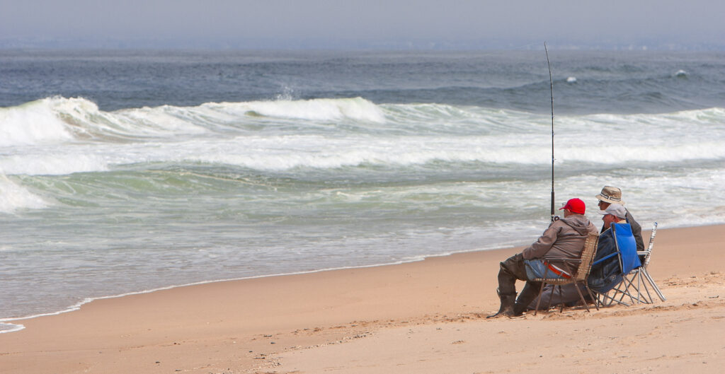
Surf fishing at Guadalupe-Nipomo Dunes offers a rugged, remote, and highly rewarding experience. Because it gets far less foot traffic than neighboring beaches like Pismo, the fish are plentiful and the crowds are virtually non-existent. Barred Surfperch are the undisputed king of the dunes and constitute over 95% of the catch here. They are incredibly fun to catch, put up a great fight on light tackle, and make for excellent fish tacos.
I rarely photograph pets. For me, outsourcing the whole endeavor to a portrait artist is arguably the smarter move, since no amount of squeaky toys or treats held above the lens ever gets a real dog to hold a pose, keep its ears up, and wear glasses without immediately trying to eat them, whereas a pencil and a steady hand can produce a golden retriever grinning like he’s hosting a late-night talk show and a doodle looking primly bookish in a bow, both indefinitely patient and never once smudging the frames with a wet nose.
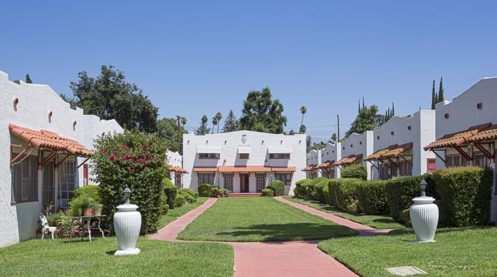
Built in 1927 by prominent local real estate and fire insurance salesman Melvin L. Hooper, Regal Court is a historic bungalow apartment complex located on Michigan Street in South Redlands, California. Designed specifically with rentals in mind, the property was configured as a classic U-shaped court featuring ten single-story units flanking the sides and a two-story building anchoring the rear. The architecture boasts striking white exterior walls contrasted by red terra cotta tile awnings over the entryways and windows. When it first opened, Hooper spared no expense in ensuring the property offered an exceptional amount of natural light, engineering each unit to be illuminated from four sides, while also installing advanced artistic exterior lighting that illuminated the entire complex after dark.
Inside, the units combined consistency with unique individual charm, showcasing subtle layout variations alongside high-end amenities for the era, such as dedicated fireplaces, elegant mantels, and space-saving wall or concealed beds. To appeal to discerning tenants, the apartments originally came entirely turnkey, fully furnished with matching rugs, sofas, tables, chairs, silverware, and even personal carpet sweepers. Remarkably, Regal Court has functioned continuously as a rental community for roughly a century while retaining its core structural integrity. Serving as a preserved snapshot of early twentieth-century multi-family housing in the region, the complex remains a standout fixture of Redlands’ architectural and residential history.
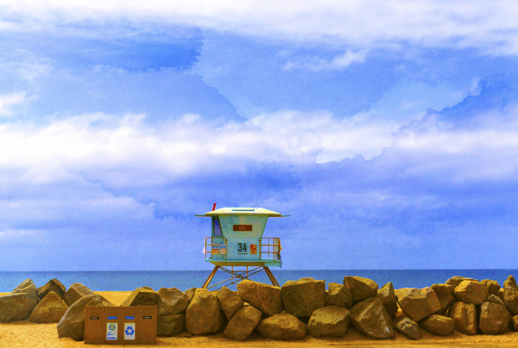
Around Station 34, the beach shifts with tides, seasons, and the steady movement of sand, creating a backdrop that is always in motion. Early mornings often bring soft light and a sense of stillness, while afternoons fill with families, board‑carrying locals, and the layered sounds of coastal life. The lifeguard presence adds a subtle structure to all of this, shaping how people move through the water and how the beach community forms around shared space.
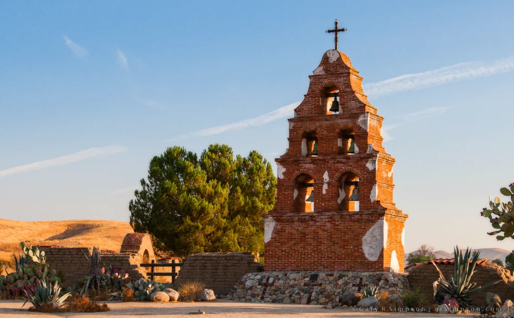
Unlike many other California missions, Mission San Miguel Arcángel did not originally possess a formal bell tower; for most of its history, the bells hung from simple wooden structures or a unique campanario (bell wall) made of adobe and river rock. The prominent bell tower visible today is not an original historic structure. It was constructed during restoration efforts in the 1920s, 1930s, and 1950s (sources vary slightly on the exact completion decade, but agree it is a 20th-century addition) to securely hold the mission’s massive bells. The tower is built of mortar and river stone, distinct from the adobe of the main church, to support the weight of the bells, including a central 2,000-pound bell cast in San Francisco in 1888 from fragments of older mission bells.
The unincorporated community of Seven Oaks, California, in the San Bernardino Mountains
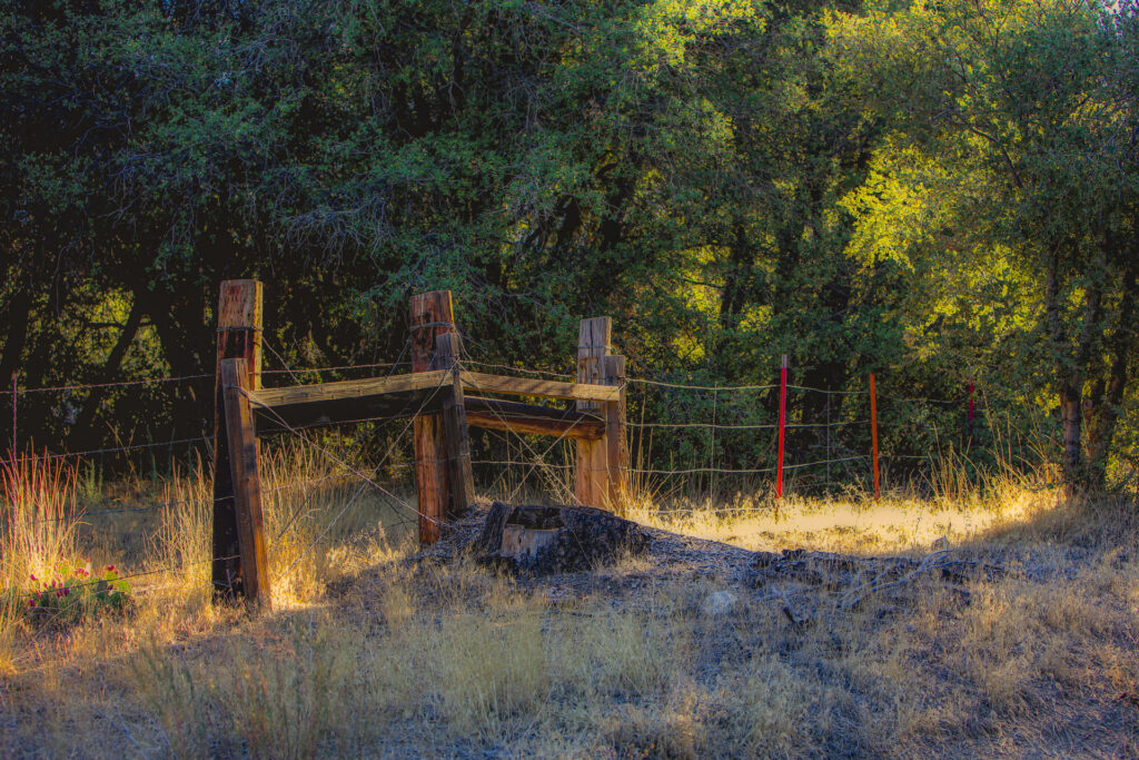
Cattle ranching came to the San Bernardino Mountains in the mid-1800s as herders like the Talmadges and Dunlaps drove stock up seasonal trails from the desert and valley floor into high meadows such as Little Bear, Bear, and Holcomb Valleys, and Seven Oaks itself sat along this route in the Santa Ana River canyon, having started as a sheep and cattle operation before Charles Lewis turned it into a resort in the 1870s-90s. Open range grazing was the norm through most of the 19th century, with cattle roaming freely across unfenced public and private land, until Joseph Glidden’s 1874 patent made mass-produced barbed wire cheap and practical, and it spread westward through the late 1870s and 1880s, transforming mountain ranching much as it did the rest of the American West; agricultural wire fencing generally stood around four feet tall using rot-resistant wood or steel posts, with barbed wire making it economically feasible to enclose rangeland for the first time, and this same shift would have reached line camps, corrals, and grazing allotments in the Seven Oaks and upper Santa Ana River area as mountain cattlemen fenced meadows, water sources, and driveways to manage herds moving between desert winter range and high-country summer pasture.
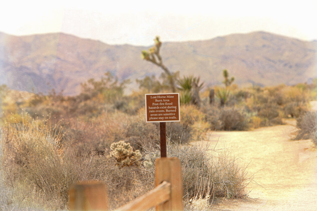
The Lost Horse Mine burn area in Joshua Tree National Park is gradually recovering through a combination of natural regeneration and ongoing restoration efforts. Native shrubs, grasses, and wildflowers are beginning to reestablish themselves, helping stabilize the soil, reduce erosion, and provide habitat for returning wildlife. While some trees and larger vegetation may take decades to fully recover, the resilience of the desert and woodland ecosystems is evident as seasonal rains encourage new plant growth across the burned landscape. Land managers continue to monitor the area for invasive species, protect sensitive habitats, and support healthy ecosystem recovery, ensuring that the burn area can slowly regain the diversity and ecological functions that existed before the fire.
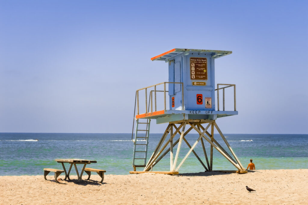
At Doheny State Beach in Dana Point, California, the lifeguard infrastructure is anchored by a main Lifeguard Headquarters, but the day-to-day eyes on the water belong to individual towers spaced along the coastline.
Lifeguard Tower 6 is positioned on the day-use side of the park, which sits north of the San Juan Creek river mouth. This specific area is renowned as a world-class, beginner-friendly longboard surfing destination. Because the waves here break gently over a shallow, rocky reef further out, Tower 6 oversees a highly active zone popular with novice surfers, stand-up paddleboarders, and swimmers. Lifeguards stationed at Tower 6 primarily focus on monitoring the unique hazards of this stretch of beach. The mixing of swimmers and watercraft is a constant safety priority, alongside managing the stingray shuffle zone and monitoring local rip currents that can form near the creek jetty. Like the other seasonal towers along this stretch, Tower 6 operates heavily during the peak summer months and weekends when the beach sees its largest crowds.
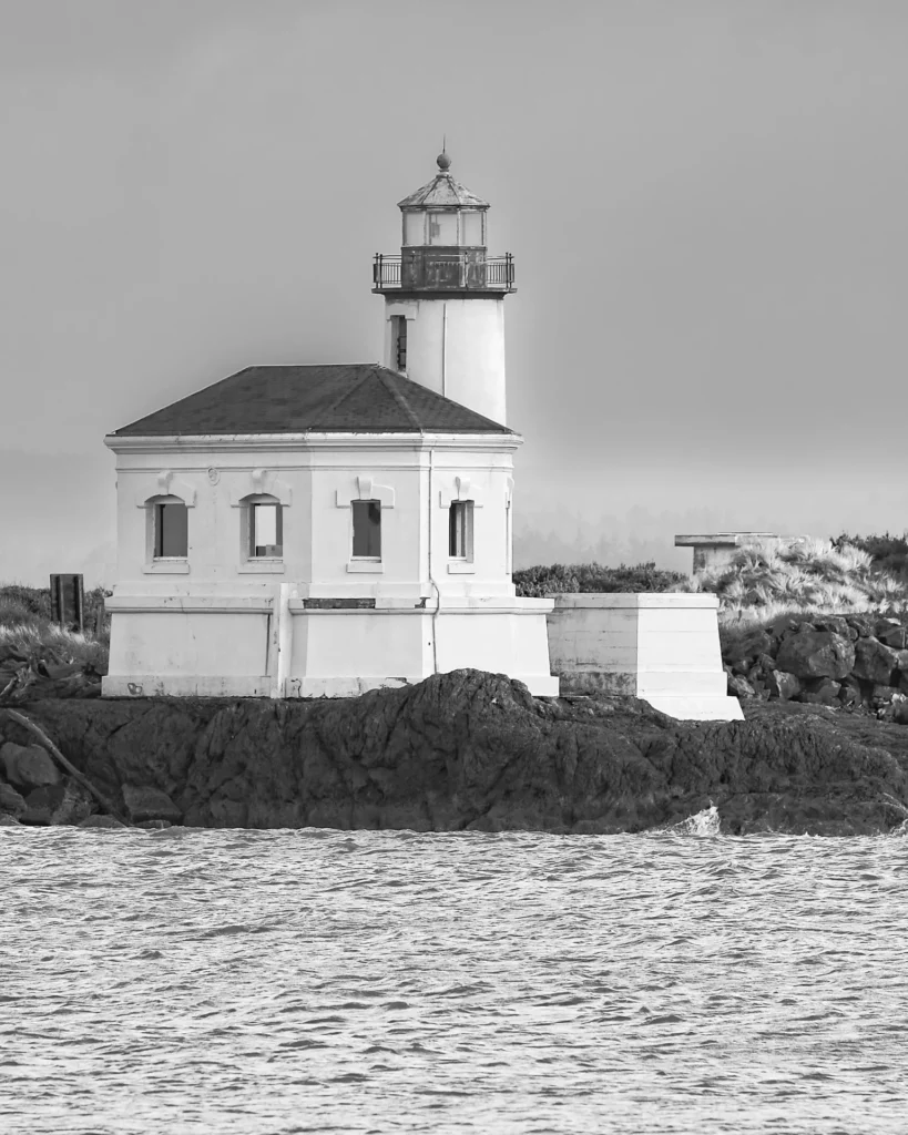
The Coquille River Lighthouse was built between 1895 and 1896 at the mouth of the Coquille River near Bandon, Oregon, to help ships safely navigate the hazardous river bar and nearby Pacific coastline. Congress approved funding for the project in 1891, but construction was delayed by planning issues and difficulties acquiring the land. Work finally began in the spring of 1895, using locally quarried stone for the foundation and brick coated with stucco for the distinctive lighthouse structure. The lighthouse’s fourth-order Fresnel lens was first illuminated on February 29, 1896, making it the last government-built lighthouse completed in Oregon. Its unique elongated octagonal design and attached keeper’s quarters made it one of the most distinctive lighthouses on the West Coast, and it served mariners until it was decommissioned in 1939.
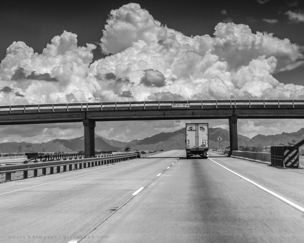
Towering convective clouds like these are a familiar and fairly common sight along eastbound Interstate 10 across much of Texas during the warm season, particularly from late spring through early fall when intense daytime heating and abundant moisture fuel vigorous atmospheric development. On many afternoons, travelers can expect to see large cumulus clouds building into impressive vertical formations, especially across central and eastern portions of the state, while similar scenes may also occur farther west during the summer monsoon or ahead of approaching weather systems. Although not every day produces clouds of this exceptional size and definition, dramatic cloudscapes like these are frequent enough that they have become a hallmark of summer driving across the broad Texas landscape, where expansive skies allow their immense scale to dominate the horizon.